WELCOME TO THE REPTON VILLAGE SOCIETY PAGES
VILLAGE DESIGN STATEMENT
REPTON & MILTON
VILLAGE DESIGN STATEMENT
October 2016 Update – Factual Inaccuracies Corrected
| Contents Main 1. Introduction 2. The Landscape Setting of the Settlements 3. Building Form and Layout Supplementary Information 4. The History of Repton & Milton 5. Transport and Communications 6. Community and Economy 7. Acknowledgements 8. Further Information 9. Map |

1. Introduction
In order that the character of Repton and Milton shall endure, it is essential that all possible steps be taken to define, preserve and improve the features that make the villages distinctive. It is hoped that this document will be a guide for anyone planning development in or around the villages, for a householder wanting to build an extension or make alterations to existing buildings and landowners planning tree felling or new planting.
The Village Design Statement
What is it?
The Village Design Statement (VDS) endeavours to describe Repton and Milton and their surroundings as they are today, highlighting the individual and collective characteristics that make the settlements distinctive. The VDS has been compiled by local residents, through a process of public consultation, with help and advice from Officers of the South Derbyshire District Council and support from the Repton Parish Council and Repton Village Society.
How does it work?
The VDS adds local guidelines for Repton and Milton to the overall policies on housing, environment etc. contained in the South Derbyshire Local Plan. As such the VDS does not cover all the policies and requirements to be met by a development, alteration or tree felling in the conservation area. The Local Plan covers many issues, some applicable to Repton and Milton, such as; policies and definition of the development boundaries, conservation areas, environmentally sensitive areas (e.g. the Old Trent and the Osier beds on Main Street), areas of open spaces and undeveloped land (e.g. The Crescent, Saxon Croft field, Matthew’s Farm and near the Mitre), as well as policies on developments in villages and the countryside and listed buildings.
The Local Plan and Supplementary Planning Guidelines (including Conservation Area Character Statements) should be the first references addressed in a planning application. The VDS supplements them with those aspects particular to Repton and Milton. Some aspects such as density of housing and parking requirements are set in national Planning Policy Guidance Notes (PPG’s). The local guidelines in the VDS can be used when residents comment on planning applications. These guidelines are not intended to be exhaustive, but are included to assist any person considering design change in order to integrate it into the parish.
Why do we need it?
It is to ensure changes that take place in the future fit in with what is best in Repton and Milton today. It lays down what residents feel is important and is readily available to residents, developers and local planners, to help in the process.
Supplementary Information
Information on the history of Repton and Milton together with comments on the transport, communications, community and the local economy compiled while generating the VDS have been included in a separate document. The supplementary information does not form part of the structure of guidelines relevant to the latest requirements of a Village Design Statement for planning purposes but reflect information and concerns expressed by people living in the community and as such are available so the information is retained. The document can be found at www.reptonvillage.org.uk
2016 Update
The Village Design Statement has been reviewed in the light of changes in the Parish of Repton and Milton. A review of the guidelines shows that the only change is to recognise the need for housing for the elderly and the guidelines support the policies in the Neighbourhood Plan.
Repton
Repton is a village with a long history. It was the ancient capital of Mercia where in AD 653 Christianity was first preached in the Midlands. The conversion of the Mercian royal family led to the building of the 8th century crypt that now forms part of the church. Repton was invaded in 873-4 by the Vikings as an over wintering place, the defences included the religious buildings. The area was subject to extensive archaeological work in the 1970s and 1980s. The Augustinian Priory was founded in 1172 and the church much enlarged between the 13th and 15th centuries. There were statute fairs, based round the Cross, from medieval times up to the end of the 19th century.
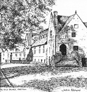
The Priory was closed when Henry VIII caused the dissolution of the monasteries in 1538. Many buildings were demolished before a free school was set up in 1557 in what is now the Old Priory. The next major development was the building of the toll bridge to Willington in 1839. Together with the new railway station at Willington this led to a large expansion of the Public School which has had a major impact on the village.
The character of the village has been brought about by this history, subsequent changes in industry and the development of motor transport, meaning that many residents now work outside the village.
The area of the Cross and Church are obvious landmarks but the character of the village is much more diverse and will affect, and be affected by, changes in the buildings, roads and related features.
Milton
Milton is a hamlet, separate from Repton, established well over a thousand years ago, which needs protection if it is to retain its essential rural character.
Two words feature prominently throughout the history of Milton; hamlet and farming. From the late 14th century onwards, there are records of various land/property transactions, including the purchase of the Foremark estate by the Franceys family in 1387, of which Milton was a small part. Subsequently the land passed to the Burdett and Harpur families and then finally to the present owners, the Church Commissioners for England. The majority of the 80 houses in and around Milton are now privately owned.
2. The Landscape Setting of the Settlements
Repton
Situated in rolling, predominantly arable, countryside rising from the flood plain on the southern side of the River Trent, Repton is located on the northern edge of the National Forest area. Many of the local fields have ancient names handed down over the years.
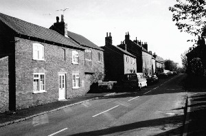
Repton is a linear village, with its main axis running roughly south-east to north-west, following the line of the gentle valley formed by the Repton Brook, as it flows northwards into the Trent. The general layout of the village can still seen to be closely based on the layout defined in medieval times. There is little building on the ridges and skylines with the exception of Burton Road and Mount Pleasant. Less than a mile to the east, over a ridge, lies the smaller linear hamlet of Milton. However the separation of Repton and Milton has been eroded by the building of 148 dwellings between Milton Road and Mount Pleasant behind Springfield Road. These developments were granted even though they were outside the existing village envelope, due to the lack of an adopted Local Plan, and are against our first guideline saying the separation between the communities should be maintained.
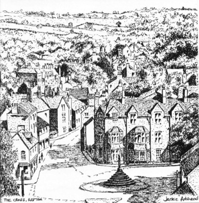
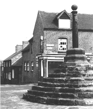
The principal thoroughfare, and main traffic route through Repton, is the High Street and Main Street, extending over a mile in length. There are two focal points along the way; firstly, at the ancient Market Cross, near to the Church and Priory, where four main roads meet and, secondly, at the Square, which has a minor cross-road.
Trees are numerous in Repton and the valley in which it sits, with oak, beech, ash, sweet chestnut, horse chestnut, alder and willow particularly well represented. Along the banks of Repton Brook there is one remaining osier bed, towards the southern end of Main Street. In 1999, on an adjacent 12-acre hillside site south of Repton, the Woodland Trust established Sledge Wood, a new plantation of broad-leaf native trees. The abundance of trees and the existence of an old field structure of hedgerows, together with wetland areas near Repton Brook, provide an invaluable habitat supporting a wide variety of wildlife.
Edges and Approaches
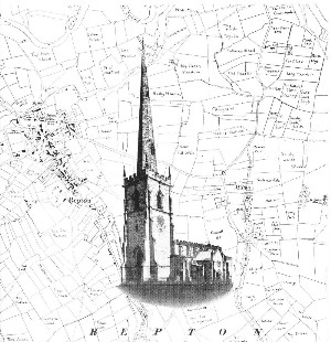
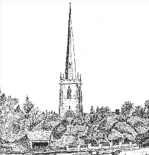
The northern boundary of Repton is well defined, being on a low escarpment above the Trent washlands. The approach to Repton across the river from Willington affords a view of the fine spire of St Wystan’s Parish Church, and the old buildings of Repton School. There is also an unattractive modern telephone exchange, only partially screened by trees and the imposing, architect designed, early 20th century sports hall. Adjacent is a complex of modern school buildings including a swimming pool, squash courts and all-weather pitches. A recent addition is a modern stone-faced Science Priory, whose size and location make it visually imposing.
Western and southern approaches from Newton Solney and Hartshorne both pass through rolling countryside, the former over the crest of a hill and the latter along the valley of Repton Brook. On entering the outskirts of the village, the two approaches are characterised by long stretches of road which are built-up on one side only, the other side being open to either arable and pasture land, or hillsides and woodland. This forms part of the character of the village.
The Eastern road, from Milton, is also open in aspect and contains some attractive buildings in Warren House and the terraced dwellings at 3 –17 Milton Road. The open aspect has been eroded by the new development above the Primary School.
Landscape in the Village
The village has a clearly defined shape and size, partly controlled by the development boundary (previously known as the Village Envelope and now referred to as the ‘Village Confines’ in the South Derbyshire District Council’s Local Plan). The demand for housing in Repton has meant that the only available new building plots have been inside this village boundary, by infilling pockets of back-land, by building on open spaces, or by the redevelopment of existing buildings.
Within the confines of the village, the remaining five significant open spaces have either full or partial public access, particularly by the many footpaths, often of medieval origin. These include the field off Mitre Drive, which houses children’s play equipment and caters for scouting activities, Matthews’ Farm by the brook, and the adjoining spinney, Pinfold Lane triangle, Saxon Croft field, and The Crescent. There are also extensive playing fields associated with Repton School. All these green spaces, plus the numerous views out into the countryside that are glimpsed between buildings, combine to bring light and openness to the centre of the village, so necessary for the maintenance of a rural identity and form the lungs of the village and a refuge for wildlife.
Generally, the street signs and lighting are of standard designs, though a number of initiatives have been carried out (in the area of the Cross, Square and village entrances) to improve the character. Often hard landscaping such as highway ‘improvements’ and kerbstones are not in keeping with the older buildings in the village, being made of modern materials. Exceptions to this can be seen around the cross but this is in need of repair due to traffic damage and corrosion of the iron in the actual cross structure.
Milton
Milton is a totally separate community from Repton. It does not have the services and facilities found in Repton and therefore the planning policies affecting it are different.
The settlement lies in a shallow valley along the westerly side of its neighbouring brook. There are several gaps between buildings that are an important characteristic of the hamlet and give views to the countryside for residents and users of the many footpaths. There is no building on the ridges and skylines in the main core of the settlement, which is contained by two road junctions; to the North to Repton or Foremark and to the South to Mount Pleasant or Ticknall. All approaches to the hamlet are lined with mature trees, grass verges and hedges and there is a pavement to Repton.
As well as the many grass verges there is a distinctive open space at the junction with Mount Pleasant, known as the village green, which is planted with trees and bulbs. There is also a wide pavement outside the Swan Public House and The Hollies farm conversion. The wide grass verge, stone walls and adjacent orchard opposite the village hall enhance the open and rural aspect at the centre of the hamlet.
Guidelines
The separation of Repton, Milton and Newton Solney should be maintained, so the individual identity of each community is not lost.
The approaches and entrances to Repton should retain their open nature with development restricted to one side of the road.
High-density developments on the edge of the villages are to be avoided to preserve the traditional open approaches to the settlements.
Open spaces have been built upon (e.g. Saxon Croft) and it is important to retain the remainder (e.g. The Crescent, Matthew’s Farm and similar spaces) in order to preserve the character of the village.
New buildings or extensions should not encroach significantly, visually or physically, upon open spaces or fill gaps that afford views of the surrounding landscape and rural skyline.
Signs, lighting, street furniture and hard landscaping should complement, not intrude on, the character of the locality.
New developments should include open spaces and play areas.
Tree planting should be encouraged where it will soften and help to integrate new developments.
Existing public land and roadsides should be improved by naturalistic planting of trees, shrubs and flowers where they add to the character of the area.
Developments and alterations that adversely affect the well-being of wildlife should be avoided. It is essential that habitats and areas which are environmentally significant be protected and ecological diversity maintained.
Where new developments are undertaken, footpaths should be incorporated whenever possible.
Alterations to the landscape should retain the local character through the use of local stone, bricks, tiling and paving where appropriate.
Developments requiring significant movements of large vehicles through the settlements must take into consideration the impact on the character of the area as well as safety, noise and environmental aspects.
The names of developments should relate to the history of the immediate locality.
3. Building Form and Layout
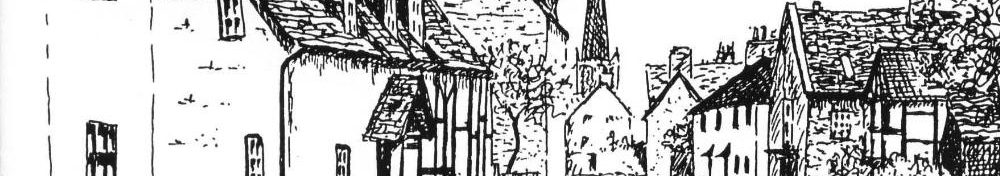
Repton
A major distinguishing feature of Repton is the mix of buildings, ranging from the 8th Century through to modern times. Repton has a high concentration of Listed Buildings and this has been recognised through the Conservation Area. This was originally defined in July 1969 and extended in February 1982. The latest assessment was carried out in January 2013 with extensions in Monsom Lane / Milton Road and changes in the Pinfold Lane areas. Residents feel this has had a major influence in retaining the character of these parts of the village.
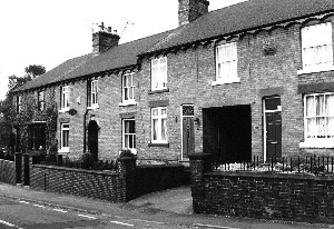
Areas of the village built before the Second World War have a mixture of a few larger distinctive older individual houses interspersed with runs of small to medium sized, generally older, homes and terraces. A major feature of the village is the strong building line and the closeness of buildings. Where houses stand back from the pavement, most have walls or hedges, which keep the building line intact.
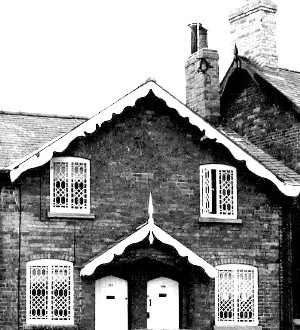
The principal building materials in the village are red brick, blue clay tiles, slates and sandstone, with some rendered, timber framed and thatched buildings. Later 19th Century bricks tend to be of a smooth finish and have a uniform colour but earlier bricks have a coarser texture and a degree of colour variation. The buildings have a varied skyline with chimneys, use stone and some decorative brickwork mainly round windows and to the eaves, and have a three dimensional effect brought about by recessed doors and windows. Detailing in brick work tends to be of a similar colour and weight to the main brick areas. Some houses still retain their original windows. These features have been carried through to the newer, smaller buildings in the area. These details form a common thread in the village but each part has its own very different and distinctive environment.
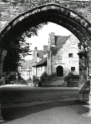
The centre of the village is the Cross, of medieval origins, and its surroundings where there are a significant number of medieval and post medieval buildings. Nearby, St Wystan’s Church is a prominent landmark and the building is well documented, including the 8th Century Crypt, one of the most important pieces of Anglo Saxon architecture surviving in England. Around here there are buildings from the 8th Century to modern times including the old Priory that dates from the 12th and 13th Centuries, but 18th and 19th Century buildings now dominate the scene. The ancient buildings are mainly of stone but Prior Overton’s Tower, part of School House, (circa 1437) is one the earliest decorative brickwork buildings in England. There are a number of cottages in the village, dating from the late 16th and 17th Centuries, on Burton Road, the High Street, near the Square and the end of Main Street (Wood End). ‘Tudor Lodge’ on the High Street is an obvious example of a timber framed dwelling of the period.

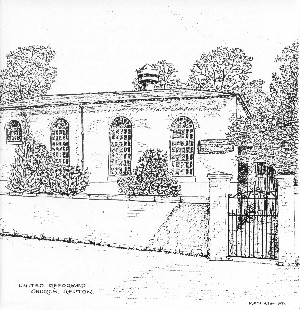
There are many Georgian buildings spread through the village, mainly of brick with some being rendered like St Wystans, 30 High Street. These buildings range from the imposing, as shown by the ‘The Grange’ on Main Street near the Square, to a number of cottages on High Street, three late Georgian examples of which retain widows with decorative iron glazing bars. Some buildings are three storey and, whilst not dominating the surrounding area, they set a solid framework for other buildings to link to. The United Reformed Church, with its tall round arched windows is another distinctive structure at this end of the village. A further region where there are a significant number of buildings from this era is around The Cross. These include the Post Office, the Repton School Art Gallery at 1 High Street and the now defunct Natwest Bank at 3 and 5, The Cross.
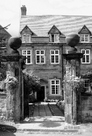
The village has numerous sizeable Victorian and early 20th Century dwellings, including one house designed by Sir Edwin Lutyens and several by other respected Arts and Crafts architects, very unusual for a settlement of this size. A significant number of these are very large buildings which were erected to accommodate the expansion of the school, are generally set in the Cross end of the village and include Pears Hall, The Old Mitre, Brook House and many others. Over the last one hundred years in-fill has taken place in streets such as The Pastures and Mitre Drive but these areas can still be characterised as having open spaces and mature trees, giving a pleasant aspect. Unfortunately the newer building has not always been carried out in sympathy with the surroundings.
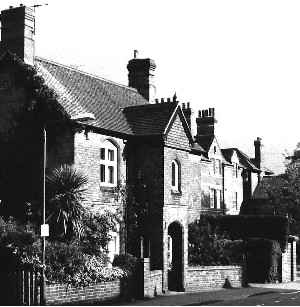
There are Victorian terraces on Pinfold Lane and Milton Road. These terraces show distinctive decorative features that enhance the buildings. The two terraces in Pinfold Lane were built at different times, but have a continuity that adds to the attractiveness of the area.
In the early post-war period the housing estate at Springfield Road, part of Askew Grove and the Crescent, were developed as local authority housing. The Springfield Road houses are in brick, whilst Askew Grove and the Crescent were mainly in Cedar wood and included some dormer-bungalows. The brick buildings tend to be of standard design with small decorative differences, whereas the cedar houses are of more interest, forming a distinctive feature of the village, however this area has been progressively re-developed with more modern houses.
In the 60/70’s, a number of small and medium developments for private sale took place. These are basically linear developments, set back from the road, with single garages. There are a few basic designs, with each house having detail differences, reflecting the style of the period rather than local characteristics. Bricks are standard light colours and there is a tendency to larger windows and flues instead of chimneys.
In the last two decades several new school boarding houses have been built. These do not imitate the surrounding buildings, but relate to them using modern materials. Recent housing has tended to be large, 4/5 bedroomed houses, with double garages in enclosed inward looking estates, one or two having gated entrances. The buildings feature highly decorative brickwork and smaller windows, but are to national designs rather than reflecting the local character. Only a couple of terraces of smaller homes were built in this period. These terraces complement their immediate areas due to the use of sympathetic materials and detail with the front doors facing the street and the way that they are aligned with and close to the edge of the street. A good example exists in Well Lane. Some affordable housing has recently been built at Longlands to meet a growing problem of housing developments not meeting local needs.
In 1990, the old Council Depot in Main Street was redeveloped as a high-technology industrial business, demonstrating how industry can be successfully incorporated into a rural village setting. The changes in the farming industry have left a number of farms and buildings redundant. Often these have been converted into small groups of individual housing. Many shops have closed and the buildings reverted to homes.
The Primary School moved to modern buildings and the original building has returned to the ownership of Repton School, which has modified and extended it to form the attractive Art Department. This is an example of a distinctive regeneration of an obsolete building. The development of the Brook House boarding house into apartments has made only minor changes to the part of the building facing the High Street and has been sympathetically extended to the rear, whilst retaining the open aspect between the house and the brook.
Repton School now accepts girl students and a number of buildings have been modified to cater for their needs as well as the provision of Abbey, Field and Garden House boarding facilities. Repton School has continued a process of refurbishment of its existing facilities. The old squash courts on Burton Road have been converted into Art Gallery. A striking new Science Block has been built (2013) on the escarpment between Willington Road and Tanners Lane but is not to everyone’s taste.
The Dales a facility for the elderly next to Fishers Close, has been closed with the Oakland Village facility in Swadlincote supposedly providing this facility. However it is difficult to access from Repton, with no direct transport links, meaning any residents from Repton are unable to maintain links with the Repton community. The future of the Dales site is presently undefined even though there is a need for local provision for the elderly citizens of Repton.
As mentioned earlier, a total of 148 houses (a significant increase in the households in the parish) have been approved on the southern boundary of Repton, away from the centre of the village. The first development, built by a Housing Association, comprises a total of 33 dwelling of which 24 are classified as affordable housing. The other 115 dwellings have no affordable housing and are not suitable for elderly residents. They are all built in a general form with no recognition of the character of Repton and its housing.
To sum up, the character of the village comes from the diversity of its buildings from all ages, yet they complement one another and form a harmonious environment but new housing developments do not recognise the character of Repton.
Milton
Milton has a number of prominent listed buildings that are often Georgian. These are interspersed with smaller dwellings that add to the character of the area.
Predominantly, the buildings in Milton follow a distinct building line, either being built directly to the rear of the pavement or having sandstone walls and hedges which keep the building line intact. The older cottages are primarily brick, some a mixture of brick and rubble stone. Modern textured render has been added to some. Early thatch roof coverings have been replaced with slate or plain clay tiles. Other buildings are mainly plain brick, with simple embellishments such as corbelled eaves courses, some with dentilled or sawtooth detailing. There are gaps and open spaces, and a few houses/cottages with side gardens – all making the character of the settlement. Sadly, some of the stonewalls and hedges have been replaced with brick walls, fences and gates, shutting off the properties from the rest of the street and reducing the open character of the hamlet.
Bramcote Lodge (not a listed building) dominates the hamlet at the northern end of the settlement envelope. It is rendered and painted, as are Kirby Holt and the Hollies. At this end of Milton there is a modern cul-de-sac, developed in the 1980s, that is of contemporary design. In this part of Main Street the terraced cottages that front directly onto the pavement, with long rear gardens, add greatly to the character of Milton. They have decorative brickwork around casement windows and to the eaves, and a varied ridgeline with chimneys.
Most of the farms in the hamlet have been developed into residential buildings, generally in keeping with the older buildings architecturally. All the farmhouses have sash windows to the ground and first floors, with casement windows in the attics. Brook Farm also incorporates the conversion of the dovecote, originally one of the few in Derbyshire. Common Farm, in the centre of the hamlet, is a working farm and has adjacent orchards enclosed with stonewalls.
At the southern end of the hamlet envelope, 4 pairs of Canadian-style, semi-detached wooden houses were built just after World War II, as temporary cottages for estate workers. Two of these were replaced, in the 1990s, by three large, brick built detached houses, which detract from the visual integrity of the hamlet.
Overall, there are about 30 new brick-built houses in the hamlet, however not all enhance the character of the area. Some cottages have been demolished and others were either knocked into an adjoining cottage or incorporated into new buildings. The older distinctive buildings provide useful references for new designs of houses or in the restoration/extension of existing buildings.
Common Farm is no longer a working farm and the land divided between other local farms.
Planning permission has been granted for conversion of the now redundant outbuildings for residential housing. The adjacent Orchard does not form part of this development and should be retained as an open green space.

Building Guidelines
New developments and alterations in the Conservation Area should reflect and enhance those elements that contribute to its character.
The development confines of Repton (as set out in the SDDC’s Local Plan) should be retained and respected.
New developments and alterations should respect and enhance the character and form of their immediate environment and surroundings.
Large or tall buildings must be in balance with the surrounding area and not unduly dominate the nearby buildings.
Development should reflect existing buildings alignment and aspect.
Proposals for frontage and boundary features should be incorporated at the planning approval stage.
Distinctive boundaries such as stonewalls are to be retained when new development takes place, in order to maintain the character of the area.
Developments should not be inward looking and separate from the rest of the community. The use of gates at the entrance of a development should be discouraged.
Details of the buildings (materials, eaves, external doors porches, windows etc.) should complement those that create the distinctive character of the local area.
Developments should incorporate the three dimensional effect of recessed doors and windows.
Brick detailing should be in balance with the surrounding buildings and area.
Care needs to be taken that the character of an older building is not spoilt by the use of inappropriate materials when replacing windows and doors.
Any new industrial developments should be sympathetic to the nature of the area.
New developments should not exacerbate on street parking difficulties.
Existing buildings that add to the character of the area should be retained even when a change of use is required.
Local traders and small businesses should be encouraged, whilst minimising any adverse impact on the character of the community. Consequently, disused farm buildings should be used for businesses, rather than converted to residential use, where practical.
Developments should take into account the requirement for affordable housing and housing for the elderly to meet local needs, including those of families and retired villagers.
Supplementary Information
The following sections do not form part of the structure of guidelines relevant to the latest requirements of a Village Design Statement for planning purposes, they were generated in the process of developing the VDS and reflect information and concerns expressed by people living in the community and as such are included so the information is retained. The comments included have been collated from surveys undertaken during the preparation of the VDS.
4. The History of Repton and Milton
Repton
Repton has witnessed, and taken part in, some major events in the history of England and the earlier kingdom of Mercia. In AD 653, it was the place where Christianity was first preached in the Midlands, to the Mercian royal family. Before long, a double abbey had been established, under an abbess, which enabled both men and women to follow their religious callings.
Early in the 8th century the famous Repton crypt was begun, which was to serve as a mausoleum for the Mercian royal family. King Ethelbald was entombed in it in 757, and King Wiglaf in 840. Initially, it was below ground level with a wooden roof but later, in the 9th century, a fine vaulted stone roof, supported by four ‘barley sugar’ columns, was constructed, and, above it, a splendid chancel was built. The distinctive Anglo-Saxon stonework can still be admired from both inside and outside the church.
It was when King Wiglaf’s grandson, Prince Wystan, was murdered by his uncle in 850, and miracles were ascribed to him, that Repton became the focal point for thousands of pilgrims to come and revere his remains. He was later sanctified and became the patron Saint of the parish church.
Repton became the ancient capital of Mercia and its earliest economic trade was as a result of pilgrims visiting the burial crypt of the Anglo-Saxon kings.
The tranquillity of the Abbey and its religious life was shattered in the winter of 873-4 when the marauding Viking armies, having sailed up the rivers Humber and Trent, decided to land their boats at Hreopedune (as Repton was called in the Anglo-Saxon Chronicle). These pagan Vikings had no use for the religious building except to incorporate it as a strongpoint in their defensive fortifications. From it they dug two deep ditches, both curving round until they enclosed a D-shaped area of some 3.5 acres between the abbey and the ‘Old Trent’ river.
Major archaeological excavations took place every year from 1974-88 in the area around the church. These not only uncovered a Viking burial mound containing the bones of 200 Viking men and 49 Mercian women, but also the ‘Repton Stone’. This was a very important find, being part of a broken Anglo-Saxon cross shaft, showing on one side a kilted warrior on a horse. It is believed to represent King Ethelbald of Mercia and, if so, it is the earliest pictorial representation of an English monarch.
In 975 a new church was built in Repton and the next historical record is in the Domesday book of 1086. This records that the manor of Rapendune (Repton) and Berewick of Middletune (Hamlet of Milton) included a church, 2 mills, some 44 households and a population of possibly 170 people.
In 1172 Matilda, Countess of Chester, gave the site at Repton for the founding of an Augustinian Priory and its resident canons ministered to the spiritual needs of many south Derbyshire parishes for nearly four centuries. Saint Wystan’s parish church was itself much enlarged between the 13th and the 15th centuries, when that elegant landmark, the 212-feet tall spire and tower, was built.
In medieval times, industry was based round the Abbey with quarrying, milling, tanning, tile manufacturing and osier products. Even at this time, there were eight alehouses in the village. There were statute fairs based round The Cross from the medieval times up to the end of the 19th century.
The next great upheaval in the story of Repton, or Repingdon, came in 1538 when Henry VIII’s dissolution of the monasteries claimed the Repton Priory. The buildings were acquired by the Thacker family, who later demolished most of them. The Priory Guest House, which we now call the Old Priory, was one of the few left standing. It was sold in 1557 to the executors of Sir John Port of Etwall, by whose will a free school for boys was set up in the Old Priory. It is no longer free, or only for boys, but Repton School, now much enlarged, is still thriving after nearly 450 years.
Repton remained a relative backwater, restricted by its lack of good communications to the north and east because the only river bridges were at Burton and Swarkestone; the alternatives being the ferries and fords at Willington and Twyford and Barrow.
However, in 1839, two major events took place which greatly benefited Repton: the building of the Toll Bridge between Willington and Repton, and the arrival of the new railway at Willington, offering both national and local connections. An elevated road or causeway was constructed across the floodplain to lead to the new bridge. The village could now expand, and Repton School could attract its pupils from further afield. Being less isolated, the people of Repton could travel and work beyond the village, which until then had been a largely self-contained, agricultural community, with its additional employment provided by the school.
The abolition of the toll charges by the freeing of the Toll Bridge on 1st August 1898 was the cause of great celebrations; the centenary of which was marked in 1998. The removal of this ‘tax’ on travelling, together with the growth of public and private transport, further stimulated employment prospects and building too.
During the late 20th and early 21st centuries Repton has continued to undergo changes and development. Many of the small businesses and shops have disappeared as travel has become easier and the majority of the residents now work and shop outside the village.

Milton
Two words feature prominently throughout the history of Milton; Hamlet and Farming.
Its origins are not certain, but it is reasonable to presume that Milton was founded by the Saxons at a similar time to Repton, between 500 and 550 AD. Middletune is the Old English name meaning Middle Farmstead or Estate (between Repton and Foremark?). The name subsequently changed to Mielton, Mieltone, Meauton, Meelton, Melton, Mylton and finally to Milton.
From the late 14th century onwards, there are records of various land/property transactions, including the purchase of the Foremark estate by the Franceys family in 1387, of which Milton was a small part. Subsequently the land passed to the Burdett and Harpur families and then finally to the present owners, the Church Commissioners for England.
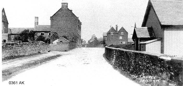
The 3-storey brick farmhouses and accompanying farm buildings, that dominate the conservation area of the village, were built in the late 18th century. The Repton Parish map of 1829 shows most of the cottages and all of the farms present in 1949. In 1890 a timber-framed Mission Room was erected, which is now the village hall. At the end of the 19th century Milton Old Waterworks were built and a fishery was established to the south of Mill Farm.
Many changes to buildings took place in the 20th century. Life was greatly improved with the arrival of electricity in 1931, the provision of mains water supply to dwellings was completed in 1950 and the installation of mains sewerage completed by 1970. Gradually properties were sold to private individuals. New properties have been built and conversions made of redundant farms and buildings. Today there are two working farms in Milton, both belong to the estate, Common Farm and a newly built Brook Farm (1992). The majority of the 80 houses in and around Milton are privately owned.
Today there is one working farm in Milton, a newly built Brook Farm (1992) which belongs to the estate. Common Farm is no longer a working Farm, the farmhouse being retained as a residential property and the outbuildings having planning permission for conversion to residential dwellings.
Milton has always been farming based and was heavily involved with associated activities, such as corn-milling, butchery and tanning, and experienced a growth of domestic buildings to support this mix of trades. Records for 1829 and 1835 refer to 4 farmers, various tradesmen and the Swan Public House. By 1841 the census shows 7 farms and an increase in other industries. The 1851 census again shows a strong agricultural industry. In the 1850s Milton still had two mills, one being at Mill Farm and the other thought to be at Robin’s Cross. A slaughterhouse existed at what is now Old Post Office Farm from the 1850s until the early 1900s and there is a building attached to that farm, which was a butcher’s shop.
5. Transport and Communications
Repton
The village has communication links via various transport means. There are five road routes into the village from Willington, Burton, Swadlincote and two from Milton. The village is served by a regular bus service. There is a mainline train station in the neighbouring village of Willington, about a mile and a quarter away. Nottingham East Midlands Airport is situated approximately 10 miles east of the village. There is an extensive network of footpaths both within the village envelope and across the surrounding farmland.
Roads
Repton lies within two miles of the junction between the trunk routes, the A50 and A38. Adjacent to this junction is the Toyota car plant at Burnaston. The proximity of these and the location of the bridge over the Trent at Willington (the only one for five miles in either direction), have lead to a substantial increase in road traffic in recent years. The bridges at Willington restrict the size of vehicles that can access Repton from the A38 and A50, causing these vehicles to use the alternative country lanes not designed for this type of traffic.
Repton is a very old settlement and the street layout, with little or no off-street parking, does not easily accommodate the influx of high levels of traffic. Two particular issues are evident. The first is the narrowness of the High Street and Burton Road in the vicinity of The Cross. This leads to severe congestion at times of high traffic density. The situation is compounded here and in other areas of the village by the various school runs. The street layout around The Cross also affects pedestrians, due to the narrowness or absence of pavements but there is now a pedestrian crossing by the Arch to ease the situation.
The other significant issue occurs on the outskirts of the village. The roads leading into Repton all cross substantial areas of farmland before reaching the first houses. The transition from open countryside to build-up area is not abrupt, leading to a tendency for speed limits to be exceeded.
The Trent Villager bus service runs to both Derby and Burton via the villages in between. This is hourly during the day but there is no late bus and it does not link to the Derby Royal hospital. The bus stop is located at Repton Cross, which is more than a mile from houses at the south-eastern end of the village. There is also a weekly, free bus, which is run by, and to, the Tesco supermarket in Burton-on-Trent.
Cyclists are often seen in Repton, either commuting or out on a leisure ride. The perceived risk to cyclists from other vehicles is a particular issue on the causeway from Willington, where the traffic speeds tend to be higher and the road is relatively narrow, making overtaking difficult.
Footpaths
Repton is unusually well provided with footpaths both within the village environment and in the neighbouring farmland. These are extensively used, the accessibility encouraging people to walk from home. Indeed, some of the paths are relatively popular with walkers from the surrounding towns and villages.
A network of hidden footpaths and ‘jitties’ criss-cross Repton and provide pleasant car-free links between different parts of the community.
Railway
The station in Willington is on the mainline between Derby and Birmingham and so could provide relatively easy access to destinations such as Nottingham and Burton. Recently the frequency of trains stopping at this station has decreased, which together with the lack of a linked bus service, reduces the usefulness of this facility.
Nottingham East Midlands Airport
The airport is both an asset and a disadvantage to the villages. The availability of local air transport helps the region’s economy and provides an accessible airport for holiday and business travellers. The downside is the level of disturbance caused by aircraft, particularly when coming into land, as they tend to be closer to the ground and are more likely to over-fly the village. The size of aircraft and the frequency of flights have increased significantly in recent years. Nottingham East Midlands Airport is biased to freight transport, which leads to a high proportion of night flying.
Milton
Milton has road links to Repton, Ticknall and Swarkestone bridge (via Foremark). Traffic levels are high as the hamlet is used as a through route. There is no longer a public transport service in Milton. The majority of residents rely on their own transport or that of neighbours. This dependence upon the motor car brings with it the problem of car parking because many residents have no garage facilities and, of necessity, have to park in the main street.
There is a web of footpaths and bridle paths linking Milton across open fields with outlying farmsteads and settlements and with adjacent villages. These are used extensively by walkers, cyclists and horse riders, both residents and visitors.
Comments – from consultation
Efforts should be made to encourage and ideally integrate, public transport services in order to reduce congestion.
Measures adopted to control road traffic should reflect lessons learnt from existing village schemes and only be introduced after full public consultation.
Pavements and road crossings should be adequate (position, surface and width) for all users including parents with young children and disabled people, particularly where public transport is not available.
Any new residential or business developments should provide adequate provision for off-street parking. Any available opportunities should be taken to provide off-street parking in the village centre.
Cycle tracks are likely to encourage more people to use bicycles as an alternative to cars and should be considered where appropriate. The risk to cyclists on the causeway to Willington should be addressed.
Footpaths within the villages should continue to be maintained. Surfaces, gates and stiles should be chosen to allow easy access to all, including provision for wheelchairs and prams, when practical.
Future growth of Nottingham East Midlands Airport should be closely monitored and resisted if seen to have a detrimental effect on the villages.
6. Community & Economy
Repton
Despite being a ‘dormitory’ village, Repton still manages to maintain a community feel highlighted by the celebration of major national and local events, e.g. The Open Gardens weekends.
Many amenities have been lost recently, including the health centre, paper shop, bank, building society, hardware shop and chemist’s shop that relocated to Willington. The public toilets are also currently closed. The local library has now been replaced by a fortnightly mobile library. However, Repton does have other amenities that are unusual in a village including facilities for swimming, tennis and other sports. There is also a music subscription programme. All these are provided by the independent Repton School, which has an impact on the economy of Repton, when it uses local shops and services.
In Repton, all ages of the community are provided for, starting with the mother and toddler groups, scouting and guiding, Repton Casuals sports club and the W.I. through to the Evergreens. There are only limited social facilities for the youth of the villages.
The Village Hall is a well-used venue for local organisations, such as the Repton Village Society, and for private functions, as is The Den. Another significant social venue is the Royal British Legion, which hosts a range of activities. The Parish and United Reformed Churches have the usual associated clubs and classes which together with the local sporting clubs and allotments, provide opportunities for villagers to meet. The monthly Parish Magazine highlights local events and is delivered to every house in the parish.
Repton has a growing number of visitors interested in the village, its history and its surrounding countryside.
In recent years, the decline in village based industries, and in particular farming, now down to two working farms, has meant a massive reduction in locally based employment. Also, the number of shops in the village has greatly diminished as residents drive or are bussed to nearby supermarkets.
The economy of Repton is that of a rural village, where most of the residents work in nearby towns and cities, but Repton School does employ a sizeable number of local teachers and support staff. The only other major local employer is Gibson Engineering, who design, build and test racing car engines. There are a number of builders, architects and other trades based in the village, who add to the village’s economy. The village has three public houses which, together with the Post Office, butcher’s shop, general store, hairdresser, three food takeaways, restaurant and tearooms, form the retail economy of Repton.
Milton
The heart of Milton is based around the Village Hall and the Swan public house. The Village Hall supports a vibrant community and holds many functions throughout the year, organised and managed by a lively Village Committee. It is home to the local W.I., police consultations and other organisations.
Formerly Church of England services were held in the Mission Room (now the Village Hall), but nowadays residents worship in nearby churches such as St Wystan’s, Repton or St Saviour’s, Foremark. Social needs (doctors, schools, shops etc) are met by neighbouring villages and towns and the mobile library no longer calls at Milton.
Usage of the Village Hall has expanded greatly due to ongoing refurbishment. New toilet facilities were completed in 2012 and a new kitchen extension, with the aid of a grant from Derbyshire County Council, was built in 2013.
Milton Village Hall is used regularly for sports activities ( including Krav Maga & Yoga,) as well as social and community events (concerts, plays, parties & monthly community lunch club) as well as being the meeting place for local organisations, and a polling station during elections.
Milton is still farming based, with 1 working farm and 2 small holdings. There are 3 small businesses in the hamlet, but the majority of residents work in nearby villages, towns and cities. Despite this change, Milton retains a strong rural character.
In line with the current agricultural trend, farms have become larger and currently there is one working farm in Milton. However Milton remains predominately agricultural with the major part of Milton’s approximate 1300 acres being farmed by local long established farming families from within the parish. This creates continuity of husbandry and local agricultural tradition. In addition there are 2 smallholdings and several dwellings which have land attached which is often used for equine pursuits.
There are some small businesses in Milton, but apart from the Public House these are generally individuals working from home and do not offer any employment.
The majority of residents work in nearby villages, towns and cities. Despite this Milton retains a strong rural character and a proud sense of community.
Comments – from consultation
The existing amenities and facilities need to be preserved and participation in events encouraged.
Changes to facilities are to address their impact on their continued availability to an aging population.
Recreational facilities need to be provided near their users to maximise their access and usage and to minimise travel and traffic issues.
Further links should be built between the local schools and the community.
Any facilities to encourage tourism should be supported.
7. Acknowledgements
The support, contributions and comments of the communities of Milton and Repton without whose input this document could not have been produced.
Financial support from:
The Repton Village Society
Repton Parish Council
Contributions from the residents of Repton & Milton with special help from:
Peter Rainey, Polly Faulkner, Barbara McArdle, Caroline and Ewan Thompson,
David Guest, Alan Kimber, John Shortt
Repton Primary School
Line drawing illustrations courtesy of local artists Ken Ash and Jackie Adshead, Web site: www.jackieadshead.co.uk
Support from:
South Derbyshire District Council (in particular the Planning Department)
8. Further Information
“The Repton Trail” – Published by the Repton History Group
Registered Charity No. 1017835