Welcome to the Repton Village History Group.
Here you will find a description of the RVHG, including a brief outline of the activities of the group and details of many of the interesting historical facts associated with this ancient community.
Click here for the latest articles and website updates: Latest News
The historical significance of Repton is out of all proportion to its present-day size and status as a pleasant village on the south bank of the River Trent in the southernmost part of Derbyshire. From its beginnings as an Anglo-Saxon settlement on the low gravel bluff overlooking the floodplain of a navigable river, Repton has witnessed, and taken part in, some major events in the history of England and the earlier kingdom of Mercia

Thirteen hundred and fifty years ago, in AD 653, Repton was the place where Christianity was first preached in the Midlands. Four priests were sent from the kingdom of Northumbria to Repton to convert the Mercian royal family from their paganism so that a royal wedding could take place. Christianity soon spread and, before long, a double abbey had been established, under an abbess, which enabled both men and women to follow their religious callings.
Early in the 8th century the famous Repton crypt was begun, which was to serve as a mausoleum for the Mercian royal family. King Ethelbald was entombed in it in 757, and King Wiglaf in 840. Initially, it was below ground level with a wooden roof but later, in the 9th century, a fine vaulted stone roof supported by four ‘barley sugar’ columns was constructed, and, above it, a splendid chancel was built. The distinctive Anglo-Saxon stonework can be admired from both inside and outside the church. Sir Nikolaus Pevsner wrote: “…the chancel….and the crypt form one of the most precious survivals of Anglo-Saxon architecture in England.”
It was when King Wiglaf’s grandson, Prince Wystan, was murdered by his uncle in 850, and then miracles were ascribed to him, that Repton became the focal point for thousands of pilgrims to come and revere his remains. He was later sanctified and became the patron Saint of the parish church, with his Saint’s day on June 1st., the date of his death. Repton’s other famous saint is Saint Guthlac.
The tranquillity of the Abbey and its religious life was shattered in the winter of 873-4 when the marauding Viking armies, having sailed up the rivers Humber and Trent, decided to land their boats at Hreopedune (as Repton was called in the Anglo-Saxon Chronicle), having found its dry riverside suitable for making their winter encampment. These pagan Vikings had no use for the religious building except to incorporate it as a strongpoint in their defensive fortifications. From it they dug two deep ditches, both curving round until they enclosed a D-shaped area of some 3.5 acres between the abbey and the river. Nowadays the Trent’s main channel flows past Willington , thus leaving Repton with the ‘Old Trent’ as a picturesque backwater
Major archaeological excavations took place, directed by Martin and Birthe Biddle, and the late Dr.Harold Taylor, every year from 1974-88. These were not only around the east end of St.Wystan’s church, but also in the vicarage garden, where the remains of an 8th century stone chapel was found, on top of which was a Viking burial mound containing the bones of 200 Viking men and 49 Mercian women, presumably wives or camp followers. Another Viking cemetery is at nearby Ingleby, which was one used for cremations not burials.
Outside the chancel wall, amongst many burials, the skeleton of a Viking warrior with his sword by his side was excavated. The “Repton Stone” was also a very important find, being part of a broken Anglo-Saxon cross shaft, showing on one side a kilted warrior on a horse. It is believed to represent King Ethelbald of Mercia and, if so, it is the earliest pictorial representation of an English monarch.
For the two centuries following the Viking incursion there is nothing recorded until William the Conqueror ordered his Domesday survey in 1086 and Repton was shown as Rapendune. It must have been of some importance because it was shown to have not one but two priests serving the parish church at that time.

The next great upheaval in the story of Repton, or Repingdon, came in 1538 when Henry VIII’s dissolution of the monasteries claimed the Repton Priory. Its buildings were acquired by Thomas Thacker, steward to Thomas Cromwell, and later inherited by his son, Gilbert. It was Gilbert who, alarmed at the prospect of the re-establishment of the monasteries under Mary Tudor, had the greater part of the Priory demolished, including the magnificent Priory Church, “to destroy the nest for fear the birds should nest there again.”
The Priory Guest House, which we now call the Old Priory, was one of the few buildings left standing. It was sold in 1557 to the executors of Sir John Port of Etwall, by whose will a free school for boys was set up in the Old Priory. It is now no longer free, or for only boys, but Repton School, now much enlarged, is still thriving after nearly 450 years. Many buildings within the village belong to the School, or to its teaching staff, and several open spaces are preserved for use as sports fields that otherwise might have been built upon.

By looking at a modern map of Repton, and comparing it with older maps, it is quite easy to envisage the size and the shape of the village several centuries ago.
Its post-war roads and estates can be deleted, and all the latter-day infilling of vacant plots can be ignored for this purpose. Repton is clearly a linear village, one that has its main axis running roughly south-east to north-west, following the line of the gentle valley formed by the Repton Brook as it flows northwards into the Trent. Two water mills (priory and village) were once driven by the Brook.
The principal thoroughfare, and main traffic route, through Repton is the High (or Long) Street and Main (or Mill) Street, extending over a mile in length. There are also two focal points along the way: firstly, at the ancient Market Cross, near to the Church and Priory, where four main roads meet, and, secondly, at the Square, which has a minor cross-road, and was once a centre for various trades. Some villagers still refer to these two areas as ‘top’ and ‘bottom’ Repton, almost as if they were separate communities.
The village, like the Old Trent itself, might have remained a relative backwater in terms of travel and trade, because of its poor access northwards towards the county town of Derby. The only river bridges were at Burton and Swarkestone, and the alternatives were the ferries and fords at Willington and Twyford.
However, in 1839, two major events took place which greatly benefited Repton: the building of the Toll Bridge between Willington and Repton, and the arrival of the new railway at Willington, offering both national and local connections. An elevated road or causeway was constructed across the floodplain to lead to the new bridge. The village could now expand, and Repton School could attract its pupils from further afield. Being less isolated, the people of Repton could travel and work beyond the village, which until then had been a largely self-contained agricultural community, with its additional employment provided by the school.

The abolition of the toll charges by the freeing of the Toll Bridge on 1st August 1898 was the cause of great celebrations, the centenary of which was marked in 1998. The removal of this ‘tax’ on travelling, together with the growth of public and private transport, further stimulated employment prospects and building too.
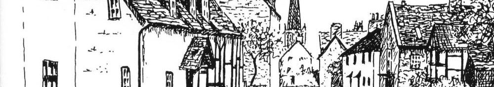
The main core of Repton village was designated as a Conservation Area in 1969, and extended in 1982. There are some forty buildings listed as being of historical and architectural interest, and many of them are shown in the “Repton Trail” leaflet, published by the Repton Village History Group.
Further detail is provided here: Repton and Milton’s Inheritance – A brief history of the parish identifying significant features and buildings – with maps.