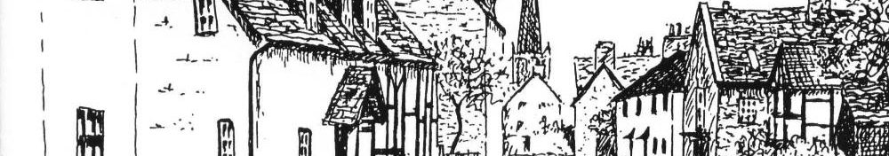
Welcome to the Repton Village News Website
Here you will find information about Repton today – click on the buttons below.
The following short walks were originally published by David Guest, Alan Webster and Sue Ellis in a series of free pamphlets called “Repton Rambles.”
Walk 1 – The Lord Mayor’s Walk
Distance: 4 Miles. Time: 1 ¾ Hours

Please follow the country code:
Guard against fire.
Fasten gates.
Keep dogs under control.
Keep to paths.
Avoid damaging fences, hedges, walls or growing crops.
Leave no litter.
Do not pollute streams, ponds or cattle troughs.
Protect wildlife, plants, trees.
Respect the life of the countryside.
| Start: | St Wystan’s Church |
| Buses: | Trent/Barton Buses Villager V3 from Derby or Burton |
| Car Parking: | By church or car park in Burton Road |
| OS Map: | Pathfinder 1:25,000 Series Sheet SK22/32 Burton-onTrent |
| Waymarks: | The walk is waymarked with yellow arrows on green discs or signposts throughout most of its length. |
| Footwear: | Footpaths can be very muddy in places during winter months and after prolonged rain, suitable footwear should be worn. |
Park in front of the Church. Walk along the High Street past the Bull’s Head public house, and at the Square (interior decorators on the right) continue into Main Street. After 150 yards turn right beyond the Queen Anne house called The Grange (built in 1703 for Joseph Holbrook, a former Lord Mayor of the City of London) and into Broomhills Lane. At the top bear left and across the farmyard. Follow the track out of the farmyard and, where it bears left at the top of a slope, keep straight ahead on the well-marked path across the field. Go over a stile and across the next field to a double stile. Cross the next narrow field.
Note the undulations known as ridge-and-furrow which resulted from mediaeval ploughing methods. After crossing the next stile bear right across three fields heading towards an electricity pylon. Keep right of the pylon, go through a gate, and make for a white gate in the roadside hedge near the left hand end of the farm buildings. Pass through this gate and onto Knight’s Lane and turn right. Walk along the right-hand side of the road past Broken Flats Farm. Note the attractive roof tile patterns.
After ¼ mile, opposite the entrance to Hill Farm, cross the stile on the right and walk down the field with the hedge on your left. Skylarks can be seen rising from the fields, and yellow hammers in the hedges, with wrens, robins, sparrows and partridges about. There are good views across the Trent Valley at this point. On a clear day Tutbury Castle and also the hills of the Peak District beyond Ashbourne are visible. Where the hedge bears left at the bottom of the slope notice the spring source on the right with its blocks of stone now scattered and where the cattle drink the water. It is the source of the stream which later flows down Well Lane and into the Repton Brook.
Go through the right-hand gate at the end of the field and straight across the next field towards a solitary tree, but following the path, and then bear right, heading towards the distant cooling towers. This takes you past the remains of Cockey Barn, where a derelict farmcart rests among the stone ruins. Continue on and pass through a gate (the spire of Winshill Church can be seen on your right) and walk across the field, keeping straight on where two paths meet about half way across. Cross a stile and bear right towards a tree in the middle of the field and on to a stile at the far side. Cockey Barn Farm is on your left. Cross a stile and bear slightly right across the next field to a gate in the right-hand corner. Pass through this gate and turn right along the track between fences.
At the junction of tracks keep ahead over the stile. Follow the footpath and stiles until you reach Chestnut Way. Wild cherry blossom in season grows in the jetty into Chestnut Way. Cross this road, diagonally to the right, and follow the narrow path between houses and round a playing field, over a new stile and on to Mitre Drive. Turn left and walk down to the Burton Road and turn right and past the Red Lion Public House to get back to the Cross and the Church.
This “Repton Rambles” leaflet is one of a series of three guides published in May 1995 by the Repton Footpath Group under the auspices of the Repton Parish Council. The Repton Footpath Group walkers were Alan Webster, Sue Ellis and David Guest. The support of the Repton Village Society and the Repton Village History Group is also acknowledged.
©The Repton Footpath Group l995.
Walk 2 – Twyford Ferry and Foremark
Distance 5 1/2 Miles. Time 2 ¾ Hours
An extension to this walk by about ¾ mile via Foremark Church is also included.

Please follow the country code:
Guard against fire.
Fasten gates.
Keep dogs under control.
Keep to paths.
Avoid damaging fences, hedges, walls or growing crops.
Leave no litter.
Do not pollute streams, ponds or cattle troughs.
Protect wildlife, plants, trees.
Respect the life of the countryside.
| Start: | St Wystan’s Church |
| Buses: | Trent/Barton Buses Villager V3 from Derby or Burton |
| Car Parking: | By church or car park in Burton Road |
| OS Map: | Pathfinder 1:25,000 Series Sheet SK22/32 Burton-onTrent |
| Waymarks: | The walk is waymarked with yellow arrows on green discs or signposts throughout most of its length. |
| Footwear: | Footpaths can be very muddy in places during winter months and after prolonged rain, suitable footwear should be worn. |
Park in front of the Church. Walk to the Cross and turn left down Brook End. To your right is Boot Hill and also The Boot Public House. The high stone wall was originally built for Repton Priory and now encloses Repton School’s cricket field. The famous English cricketer C. B. Fry learned the game here and he is buried in St. Wystan’s churchyard. Notice the plaque set in the wall where the water-course of the old Prior Mill once stood. There is a hump-backed bridge over the present brook. See the cast-iron notice on it. The Brook Farm tea rooms are on the left. Where the road turns sharp right for Milton keep straight ahead and continue up to the top of Monsom Lane.
Turn left at the end of the lane and follow the track which takes you alongside the Old Trent Water on the left. This waterway is probably the route taken by the Viking army when it invaded via the Humber and the Trent before over-wintering at the Saxon settlement of Repton in AD873-4, using the church as one corner of its fortified ditch encampment. The modern course of the Trent is nearer to Willington than to Repton. Look out for chaffinches, wrens and yellow hammers in the hawthorn and blackthorn hedges. Swans, kingfishers, herons and cormorants are often seen here as well. Also look for flocks of long-tailed tits flitting between the trees. Wrens and tree-creepers may be observed.
Ignore a farm track off to the right and continue ahead and follow the footpath, crossing a stile on the left of a gate and continue ahead on the track. There is a distant view of Twyford Church to your right. Cross a stile on the right of a gate and then turn right and, keeping the hedge first on your right, and then another hedge on your left, continue straight ahead heading towards Twyford Church in the distance. After crossing several fields and stiles you reach a lane where you now turn left towards the river, but ignore the entrance to the Derby Angling Association’s car park. Follow this lane to a gateway and stile and climb over on to the grassy riverbank. Go and stand by the large wooden post and look across the river to the corresponding one on the Twyford side. This is all that remains of the chain ferry which once provided a vital crossing on this route between Repton and Derby before the building of the Willington toll bridge in 1839. The ferry remained in occasional use until the late 1930’s but the ferry-boat and its chain were still in existance in a 1958 photograph. The large pebble-ash house to the right is Tywford Hall (rebuilt in 1725-50).
YOU NOW HAVE THE CHOICE OF TWO RETURN ROUTES:-
(1) For those wanting the shorter route:- Return to the lane and walk back along it, past the disused waterworks on the left until you reach a T-junction, which is the Milton to Foremark road. Turn right here and walk into Milton, entering by the Coach House on the corner. Continue straight ahead along Main Street until you come to the footpath sign on the right which takes you through the yard and outbuildings of the farmhouse. (A public house further up the main street on the left is the Swan). For the remaining directions see section (3).
(2) If you wish to take the long route via Foremark Church, then continue on the track from the ferry crossing point, with the river on your left. Go through a gateway and head diagonally right across the field to the right of the track-way. At the far end of the field look out for a new stile, cross and follow the right-hand edge of the next field, looking for a single-plank footbridge. Turn left after crossing this bridge and follow the footpath diagonally to your left across the field to another footbridge. (If the path is not discernable you may have to follow the field edge on two sides until you reach the footbridge.) Cross this bridge and head diagonally across the next field, leaving the pylon on your left. (This field can be swampy!) In the far corner you will see a stile and then a track which leads you to the Milton-Ingleby road. Notice a fine ash tree on your left, and then a hazel/willow copse. Go over the stile, cross the road and take the track immediately opposite, and you can see Saint Saviour’s Church ahead. It is well worth a closer look as it was built entirely in 1662 in the Gothic style. It has a fine pair of wrought iron gates at the east end of the churchyard by the famous Derbyshire smith Robert Bakewell (1685-1752), and inside it retains its original box pews and a triple-decker pulpit, but do not expect the church to be unlocked.
Just before the church, to your right, you will see a waymarked stile. Go over it and go straight ahead at the end of the copse noting a pond on the left. Go straight across the next field, over the stile and go ahead between the water-trough and the pylon. The path goes downhill to a gateway by the brook, which can be very muddy, before which a stile to your left leads through to a bridge on your right, and then to a path leading to Milton village. By the brook you may see yellow breasted grey wagtails. Go almost straight across the road and find the stile next to the farmhouse, and then follow the directions from section (3).
(3) Walk through the farmyard and under the archway, continuing past the outbuilding to the far end of the yard where there is a narrow footpath leading to a wide grassy track. Cross a stile and follow the track across a field with the hedge on your left, and then over open fields heading towards Repton Church. Cross two more stiles and then head towards the houses, aiming for the corner of a close-boarded fence. Note the undulations in the last field; these are the result of mediaeval ploughing methods and are known as ridge-and-furrow. Notice also a WW2 pillbox! Turn right into Springfield Road and after about 200 yards turn left into a jitty marked by metal hoops leading into a cul-desac off Pinfold Close. Turn right and at the far end of the Close follow another jitty on the left from which a tarmac path crosses the Repton Brook and leads to the High Street. Turn right and walk back to the Church.
This “Repton Rambles” leaflet is one of a series of three guides published in May 1995 by the Repton Footpath Group under the auspices of the Repton Parish Council. The Repton Footpath Group walkers were Alan Webster, Sue Ellis and David Guest. The support of the Repton Village Society and the Repton Village History Group is also acknowledged.
©The Repton Footpath Group l995.
Walk 3 – Repton Shrubs – Repton Common
Distance: 6 Miles. Time: 3 Hours

Please follow the country code:
Guard against fire.
Fasten gates.
Keep dogs under control.
Keep to paths.
Avoid damaging fences, hedges, walls or growing crops.
Leave no litter.
Do not pollute streams, ponds or cattle troughs.
Protect wildlife, plants, trees.
Respect the life of the countryside.
| Start: | St Wystan’s Church |
| Buses: | Trent/Barton Buses Villager V3 from Derby or Burton |
| Car Parking: | By church or car park in Burton Road |
| OS Map: | Pathfinder 1:25,000 Series Sheet SK22/32 Burton-onTrent |
| Waymarks: | The walk is waymarked with yellow arrows on green discs or signposts throughout most of its length. |
| Footwear: | Footpaths can be very muddy in places during winter months and after prolonged rain, suitable footwear should be worn. |
Park in front of the Church and walk along the High Street and past the Bull’s Head public house. At the Square (interior decorator’s on the right) continue into Main Street and after about 300 yards turn left down a footpath between a house and a bungalow. Go over a stile. Note the butter burr, lesser celandines and alkanet on the left in season and cross another stile into the field where Repton Mill once stood. Cross the field, turn right at the hedge and ascend the slope to another stile and cross over. Note the remains of the mill on the right, also the mill leet or cutting through which the water was channelled to drive the mill-wheel. Keep on ahead over the next five stiles, following the footpath which runs above and beside Repton Brook. Look out for kingfishers, siskins, and many other species of birds. As you walk notice the undulating rounded hillocks on your left which were shaped by glaciation in the last ice age. Note the alder, ash and hawthorn trees on the right and, later on a row of large pollarded willows by the water. There was once a thriving industry of basket and hurdle making based on the osier beds in this area.
The path emerges on to a lane called Robin’s Cross Lane. Cross over and walk up the lane opposite, called Red Lane, which has a stone wall on the right. The locked gate once led to a large house called Repton Park which was owned by the Harpur-Crewe family. The house was demolished in July 1893 following a violent quarrel between Sir Vauncey Harpur-Crewe and his relative, John Edmund Crewe, who was the occupant at the time. If you walk back down the road to Lawn Bridge you can see the lake and cascades in the grounds.
Continue up the steep lane between the rocky outcrops of Bunter sandstone on pebble beds until you reach Loscoe Farm on the left and the entrance to Repton Park Farm on the right. Continue straight ahead along a bridleway passing the wood called Repton Shrubs on the right. Under the trees adjacent to the track you will see bluebells in season. At the top of a hill turn left and follow the road towards Fairview Farm (formerly Waste Farm). Just before the entrance to the farm drive turn left and go through a gateway down a track pointing towards Willington Power Station. Over the hedgerow on your right there are good views of the Foremark Reservoir. In the fields you may see hares, pheasants, partridges and also many birds in the hedgerows, especially yellow hammers, blue tits, hedge sparrows, wrens and chaffinches. Occasionally buzzards may be seen overhead. The track leads down to Brookdale Farm and then to Brookdale Barn, now converted into a house. Just past the Barn turn left over a flat bridge at the footpath sign and walk uphill going diagonally over two fields on a path leading to an opening between two trees in the corner of the second field. Turn back and you can see a distant view of Ticknall Church spire.
Go through the opening and cross the next field keeping close to the hedge on your left until you reach a road (Robin’s Cross Lane again). Cross over and squeeze through the pinch stile. Keep straight ahead over three fields on a path until you reach the yard of Ridgeway Farm. Walk through the farmyard and down the lane, which leads to Mount Pleasant and the pub of the same name. Walk down the road, with a good view of Repton Church spire ahead, and follow Pinfold Lane, which goes over Repton Brook and note the chapel (United Reformed Church) on the left-hand side. At the Square turn right and go back down the High Street to the Cross and the Church.
This “Repton Rambles” leaflet is one of a series of three guides published in May 1995 by the Repton Footpath Group under the auspices of the Repton Parish Council. The Repton Footpath Group walkers were Alan Webster, Sue Ellis and David Guest. The support of the Repton Village Society and the Repton Village History Group is also acknowledged.
©The Repton Footpath Group 1995.